Hurricane Melissa Becomes the Most Powerful Storm Ever Recorded in Jamaica
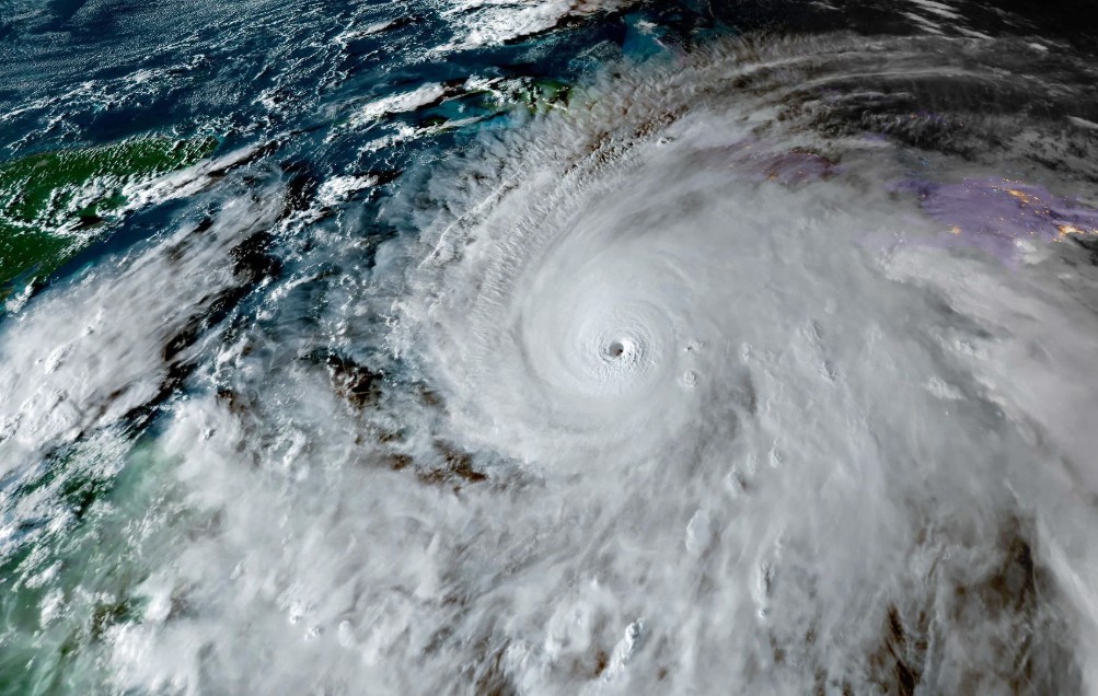
Hurricane Melissa, now a Category 5 storm, made landfall in Jamaica with sustained winds of nearly 290 kilometers per hour (180 mph) and a central pressure of 917 millibars, making it the most powerful tropical cyclone ever recorded on the island. The system, the 13th named storm of the 2025 Atlantic season, rapidly intensified over the weekend, surpassing the devastation left by Hurricane Gilbert in 1988. The U.S. National Hurricane Center (NHC) has issued its highest-level warnings for Jamaica and parts of eastern Cuba, citing the threat of catastrophic flooding, landslides, and destructive storm surges.
Jamaican authorities have ordered mandatory evacuations in vulnerable coastal zones and closed all airports across the island since Sunday, October 26. Prime Minister Andrew Holness declared a national state of emergency, urging citizens to take shelter and follow evacuation instructions as the hurricane approached with unprecedented force.
By early Tuesday morning, Melissa’s eye—18 kilometers in diameter—hovered just south of Jamaica, moving north-northeast at 8 km/h (5 mph). Sustained winds reached 282 km/h (175 mph) with even stronger gusts, making it the world’s most intense storm of 2025. Hurricane-force winds and torrential rains lashed Kingston and Montego Bay through the night, while the NHC warned of storm surges up to 4 meters (13 feet) along the southern coast, combined with hours of destructive winds and flooding due to the hurricane’s slow movement.
After crossing Jamaica, Melissa is expected to move toward eastern Cuba late Tuesday or early Wednesday as a Category 3 system with winds between 178 and 208 km/h (110–130 mph). Forecasts warn of storm tides up to 3.3 meters (11 feet) and rainfall exceeding 635 millimeters (25 inches) in some mountainous regions, increasing the risk of flash floods and landslides. By midweek, the storm will likely weaken to a Category 2 hurricane as it approaches the southeastern Bahamas and Turks and Caicos, and may pass near Bermuda by Friday morning.
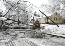
Even before making landfall, Melissa has already claimed at least seven lives and injured 13 others across the Caribbean. Jamaica’s Health Minister Christopher Tufton confirmed three fatalities on Monday night, including a health worker killed by a fallen tree in St. Elizabeth Parish. Earlier, four deaths were reported in Haiti and the Dominican Republic as the storm’s outer bands triggered landslides and widespread flooding.
For those tracking the storm, the National Hurricane Center’s official website (hurricanes.gov) remains the most reliable source for real-time updates, publishing advisories every six hours—and every three when coastal warnings are active. The NOAA’s National Environmental Satellite, Data, and Information Service (NESDIS) provides near-real-time imagery from the GOES-16 and GOES-19 satellites, offering detailed views of Melissa’s eye and convection patterns.
The NOAA Weather Prediction Center (WPC) has forecast rainfall totals between 380 and 1,016 millimeters (15–40 inches) across Jamaica and southern Haiti through Wednesday, October 29. Updated every six hours, these projections highlight the risk of catastrophic flooding and mudslides in the most affected areas.
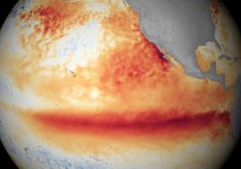
Experts warn that Hurricane Melissa underscores a worrying trend: stronger, faster-forming tropical cyclones fueled by warmer ocean temperatures linked to climate change. “This is a life-threatening situation,” said NHC Director Michael Brennan. “Everyone in the hurricane warning area should be in a safe place and remain there until the storm has completely passed.” As power outages and communication disruptions spread, Jamaica braces for the long recovery that will follow the most powerful hurricane in its history.